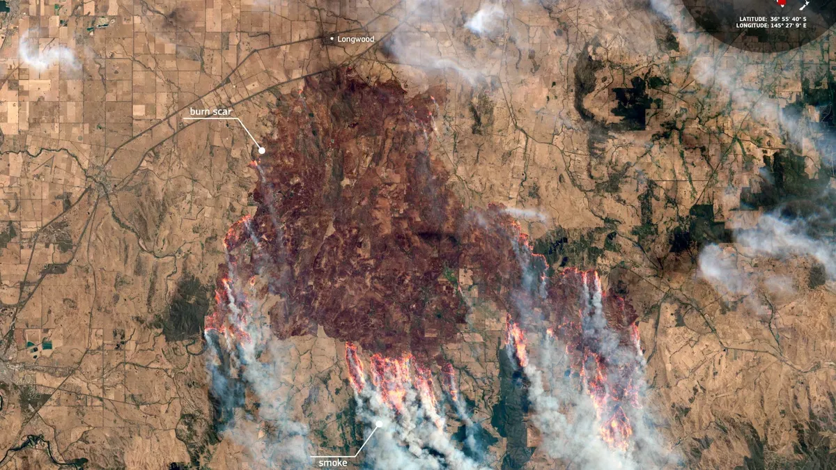
From low Earth orbit, a European satellite captured the stark, charred landscape of Australia’s bushfires—offering both a grim reminder of their scale and a tool for measuring recovery.
Sentinel-2 satellites imaged burn scars in Victoria, Australia, on January 9, 2026, south of Longwood. The Copernicus website reports that these uncontrolled fires have led to the closure of hundreds of schools and the evacuations of entire communities, resulting in thousands of people living without electricity.
The satellite’s 13 spectral bands—including near-infrared and short-wave infrared—enable precise mapping of burned areas and vegetation damage.
The Copernicus program, an Earth-observation initiative, provides critical data for policy-making and disaster response. Repeated Sentinel-2 imaging allows long-term tracking of landscape recovery post-fire.
Observed data such as burn scars and vegetation changes are distinct from modeled implications like soil stabilization or habitat restoration, which require further analysis.
By contrast, the operational role of Sentinel-2 remains focused on data acquisition. The European Space Agency emphasizes that casualty and damage figures are sourced directly from Copernicus records, avoiding speculative commentary about fire causes or climate links.